31 August 2022

A salt marsh in Morehead City, N.C.

The North Carolina coastal region includes many hundreds of square miles of salt/brackish marshland. Here are some photos of a salt marsh along Calico Creek in Morehead City (Carteret Co.).


30 August 2022

Around Silver Lake in Ocracoke Village

I know I sound like a broken record, but we've again had a couple of days with temperatures over 30ºC (above 86ºF), and tomorrow is another one. Today it's slightly cooler because there are rain showers and some thunder and lightning around the area. I saw distant lightning in the middle of the night but couldn't hear the thunder, so the activity was pretty far from here. The good news is that Accuweather is predicting high temperatures in the low 80s and even down into the 70s for all of September. Maybe August 31 will be the last day of our long hot summer.

This is the lighthouse and the lighthouse keeper's house on Ocracoke Island.

Above and below are a couple of views of the lighthouse from across the waters.


If you ever make it to Ocracoke, be sure you stop here.
According to Google Earth, no spot on Ocracoke Island (except maybe the top of a sand dune here or there) is more than three feet above sea level. Hello climate change and rising tides.

29 August 2022

Ocracoke and its lighthouse

Ocracoke Island is essentially a sandbar that is 12 miles long. At its southern tip, which is wooded, you'll find Ocracoke Village (pop. 800) with hotels, shops, and restaurants. The only practical way to get to the island is by boat, but there's a paved road all the way up and down the island. Car ferries link Ocracoke Island to Hatteras Island on the north end to and Cedar Island on the south end (Cedar Island a 40 minute drive from Morehead City). There's a third ferry line linking Ocracoke to a place called Swan Quarter (pop. 324) — a 60 minute drive from  "little" Washington, NC.

    
Above left is a first view of Ocracoke when you are arriving on the ferry from Cedar Island (pop. 350). The whole island is basically at sea level. Above right is a much closer view, taken as the ferry approaches Ocracoke's harbor, which is known as Silver Lake.

Ocracoke suffered extensive damage from flooding a few years ago when a hurricane blew through. This article leads me to believe that most of the damage has been repaired.


28 August 2022

Riding the Cedar Island–Ocracoke ferry

The ferry ride from Cedar Island to Ocracoke Island takes 2½ hours, for a distance of about 20 miles. On a beautiful day like the one we had on November 9, 2007, it's very pleasant and relaxing crossing. Here are some views.

We're on a car ferry in North Carolina waters. You can also take the ferry as a foot passenger for a fee of $1.00 and just wander around in the village for a few hours before riding back to Cedar Island.

You often see a lot of fishing boats out plying the waters.

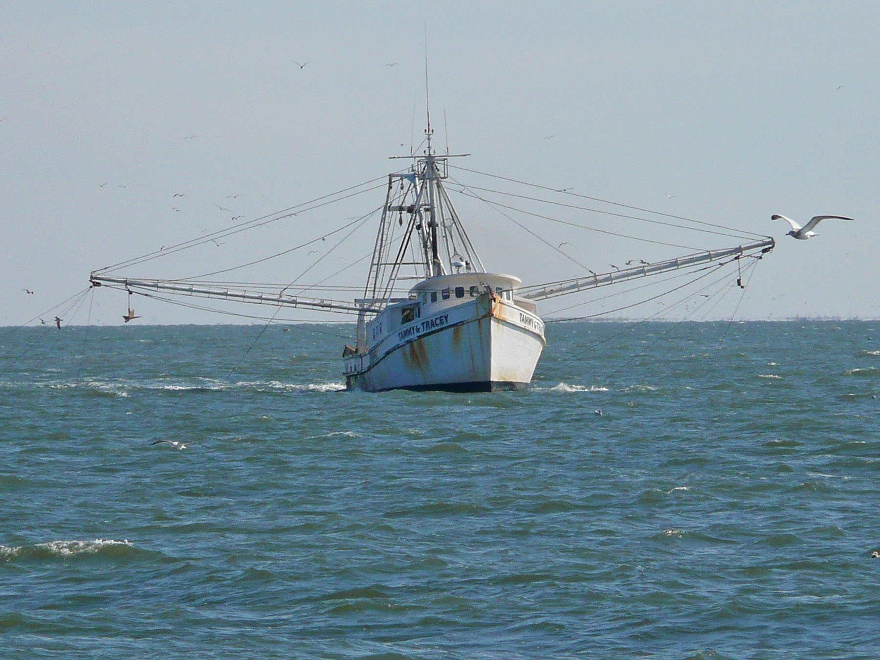
These are trawlers. I'm not sure if they were trawling for fish or for shrimp.

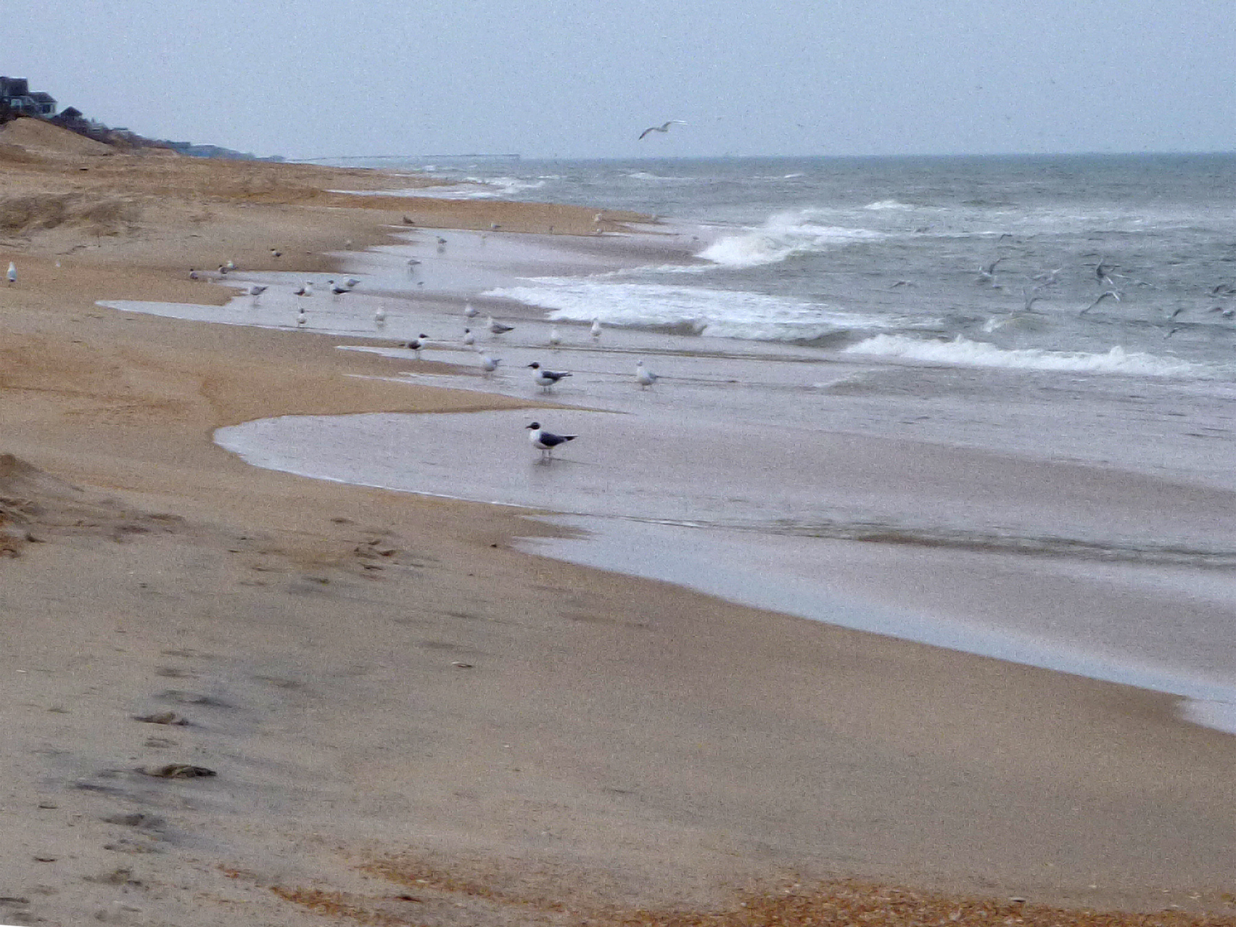
The boats are usually being followed by large flocks of sea birds hoping for some tidbits.

You will also pass ferries going in the opposite direction...

...and the stray sailboat, of course.

27 August 2022

N.C. barrier islands and inlets

Our neighbor, who is the mayor of our village (pop. 1,100), and her husband, a retired banker, are celebrating their 50th wedding anniversary this weekend. They obviously had a party last night that broke up in the wee hours — a lot of cars drove by between two and four this morning, with their headlights casting unaccustomed patterns of light and shadow on the ceiling of the loft where we sleep. Today and tomorrow we're invited to go over to the mayor's for lunch. She is bringing in a food truck to feed a crowd of 50 or more guests. That should be interesting.

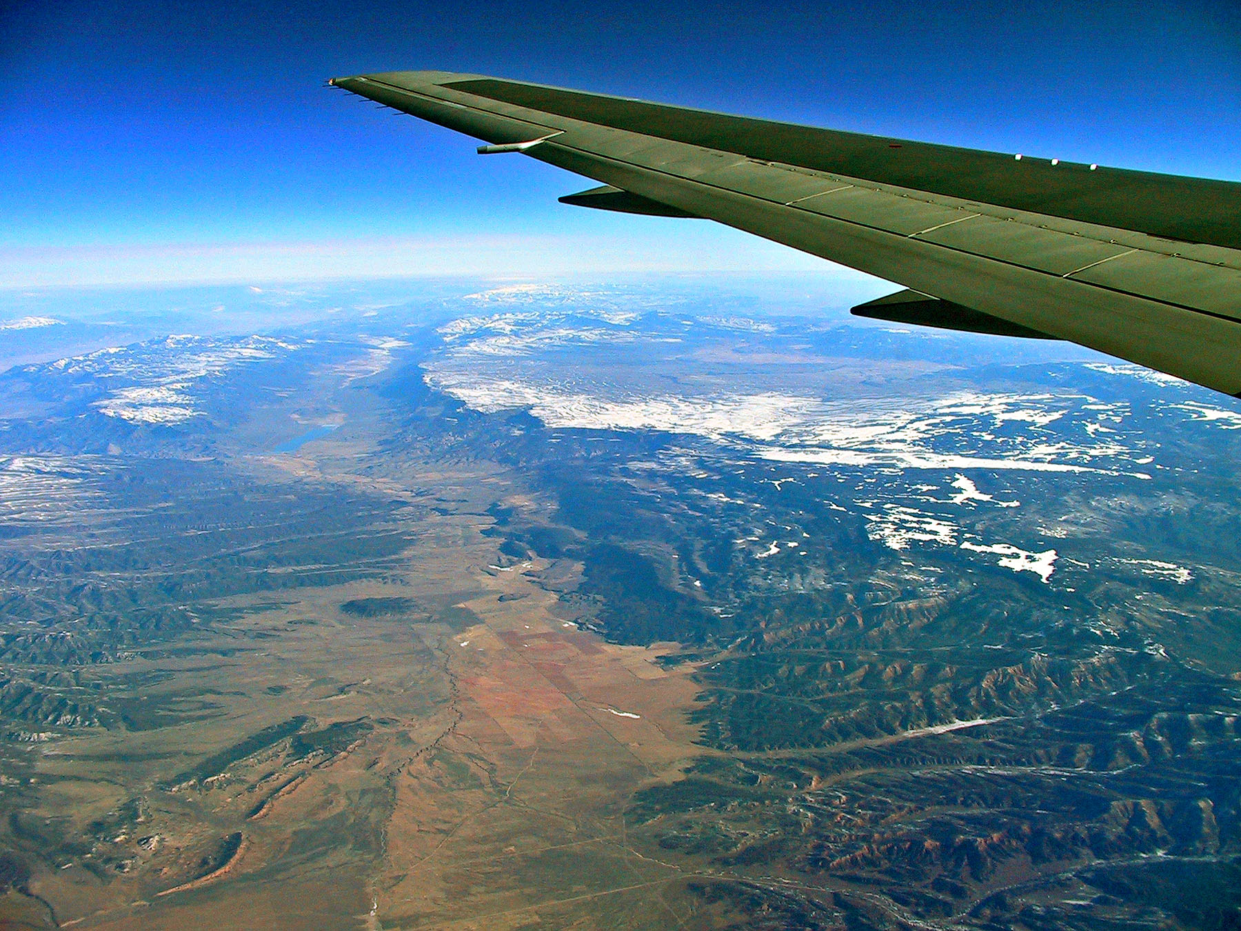
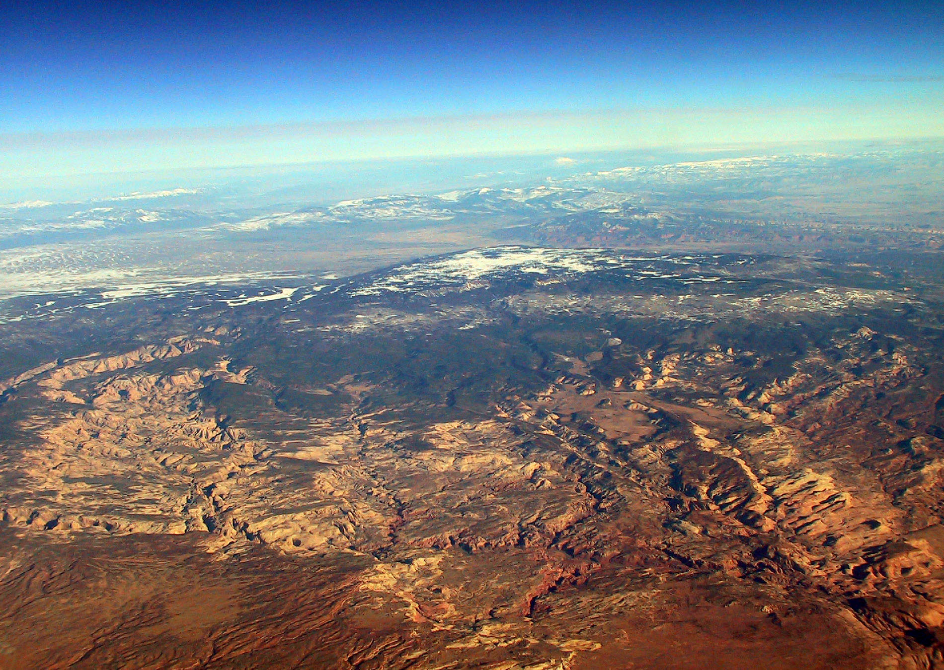
Meanwhile, here are a couple of aerial photos, taken from the windows of a plane, showing the barrier islands and inlets that characterize the North Carolina coast. Inlets are breaks in the string of barrier islands that let water flow between the sounds and the ocean. I believe they are all natural, not man-made. Strong winds and ocean currents can silt them shut or carve new inlets through the islands.


I don't know which inlets these are, but they have to be southeast of Morehead because I was flying out of New Bern, to the north, on the way to Charlotte, to the west, and from there back to Paris to catch the train to Saint-Aignan.

To cross the inlets just north of Morehead, you have very few choices: your own or a hired boat, or a car ferry to or from Ocracoke Island (pop. 800). It takes two-and-a-half hours to get to Ocracoke from Cedar Island, which is at the eastern end of Carteret County. North of Ocracoke is Hatteras Island, a forty-five-minute boat ride away.

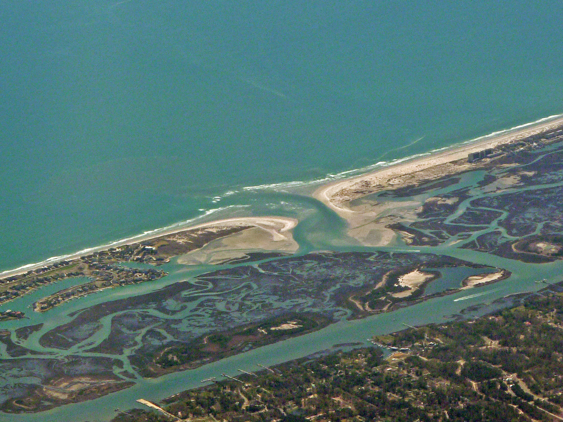
Farther north, near Nags Head (pop. 3,200) and Manteo (pop.1,600), you can cross Oregon Inlet by high-rise bridge. Manteo is on Roanoke Island (total pop. 6,750), which is where in the year 1585 the English attempted to establish a settlement in North America for the first time. (There were already 10 or 12 Spanish inland settlements in the Carolinas by then.) Women and children were brought over in 1587. Later that year, the governor of the colony left his 100 or so colonists there and sailed back to England for supplies. By the time he returned in 1590, all the colonists had vanished. Still today, nobody is sure what became of them. The more successful Jamestown settlement in Virginia would be formed 25 years later.

In Morehead, you used to be able to take the train up to New Bern and on to Raleigh or Charlotte. There are no passenger trains out of or into Morehead these days, but a single freight train, I believe, rolls through town at 15 miles per hour headed to the port terminal five times a week.

26 August 2022

Beaches of North Carolina

The North Carolina coast, on the Atlantic Ocean, is more than 300 miles (500 km) long. Carteret County and Morehead City are about halfway from NC's border with Virginia to the north and South Carolina to the south. They are also about the same distance from the capital of NC, Raleigh. I was born in Morehead City and lived there for the first 20 years of my life. I traveled to France for the first time when I was 20 years old, and I've never stopped traveling back and forth between Europe and North America since then. These are photos of NC beaches that I took in March 2010.


I'm now spending the last 20 years of my life, and hopefully longer, in Saint-Aignan, Loire Valley, France. Morehead City is about 4,000 miles (6,500 km) southwest of Saiint-Aignan, on the other side of the Atlantic Ocean. Morehead City, in fact, is farther south by two degrees of lattitude than the southernmost point of land in Europe, which is at Punta de Terifa at the southern tip of Spain. That means it's nearly 150 miles (more than 225 km) farther south than any place in Europe.

25 August 2022

Photos from the top of the bridge

In 2010 I was in Morehead and I decided to walk out on the "beach bridge" to its highest point. I wanted to take some pictures from up there. This bridge was built in 1987, replacing a drawbridge that had been built in 1953. The first bridge across Bogue Sound had been built in the 1920s. Before that, people went by boat, or waded, or swam across the sound to get to the oceanfront beaches. I remember my grandmother Daisy telling me about going to the beach by sailboat when she was young.

    
The high-rise "beach bridge" (left) lets boats pass underneath without hindering car traffic.
The town on the south side of the bridge is called Atlantic Beach (right).
The barrier island is very narrow — that's the ocean on the horizon.

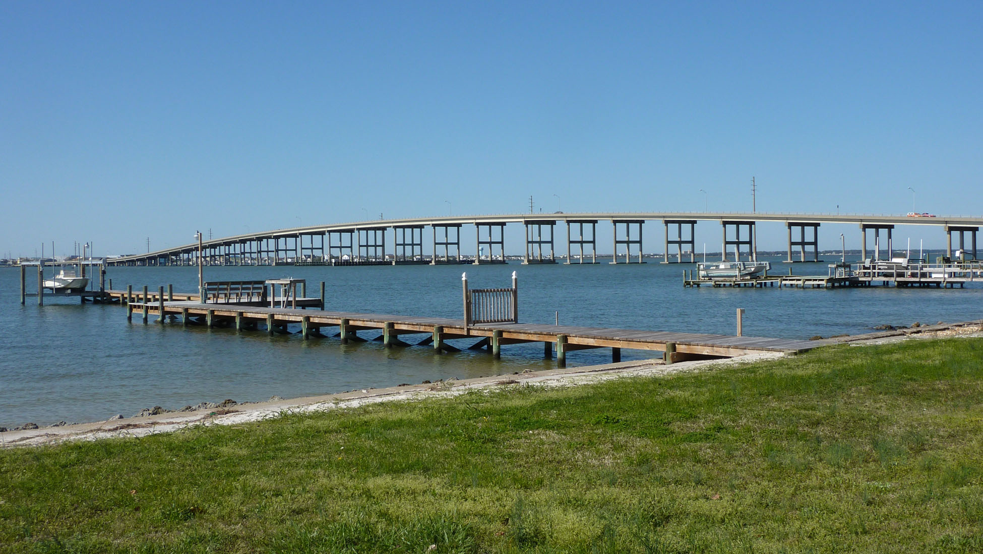
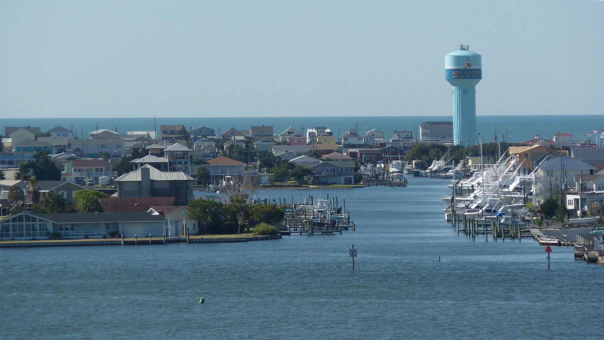
There's a lot more water than land in Carteret County NC, where Morehead City (pop. 10,000) is the biggest town.

    
Here are two views of Morehead from the top of the bridge. For many decades now, bigger and bigger houses have been built on the shores of Bogue Sound. In the 19th and early 20th centuries, people didn't want to live on the shore. It was too windy, and the danger of wind and water damage during hurricanes was too great. The photo on the right shows the downtown and the town's waterfront. The state port is beyond the waterfront. The tower with the bulbous top is a water tower (un château d'eau in French).

24 August 2022

Pélicans...

When I was growing up on the N.C. coast in the 1950s and '60s, there were no pelicans to see there.
The pesticide called DDT was the reason. After DDT was banned in the U.S. in the early 1970s,
pelicans made a comeback, as did bald eagles and peregrine falcons, among other birds.

Two pelicans and a crane

A pelican close up

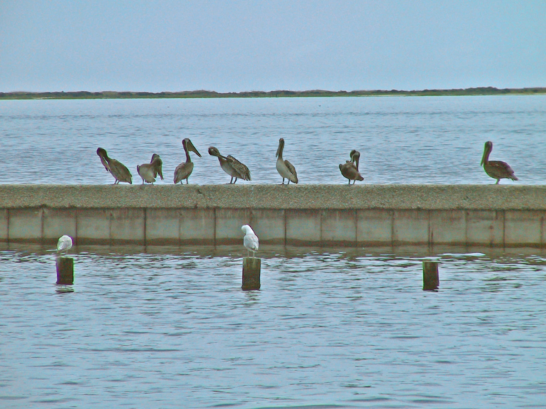
Pelicans on a wall, grooming

Pelicans with Cape Lookout lighthouse in the background

23 August 2022

Family cemeteries in Carteret County, N.C.

A web site called Cemetery Census lists well over 100, maybe 150, family cemeteries in Carteret County, North Carolina (county seat Beaufort; largest town Morehead City). The one in the pictures below is on Cedar Island, an unincorporated community (pop. 350 or so) at the extreme eastern end of Carteret county. It's variously called "the Lupton family cemetery" or "the Day-Daniels cemetery". Many of the grave markers are carved wooden planks. One section of the cemetery seems to be devoted to the graves of children who died not long after birth. The cemetery is made up of some 75 graves dating back as far as the early 1800s.


22 August 2022

Images from on high

No, I didn't take these photos in North Carolina. I took them over the western United States as I was flying from California eastward to North Carolina. I have always enjoyed taking photos out the window of a plane. It passes the time as I fly. Conditions have to be right. You need a window seat, of course, and you need good weather. I had both of those and a camera in 2002 when I took these photos (and many more).


Meanwhile, yesterday Walt and I stacked about a cord (3 or 4 cubic meters or stères) of oak logs that was delivered a few days ago. We thought stacking it was going to take a lot longer than it did. Actually, Walt did most of the work, and I contributed only in a small way. It's good that the wood is stacked and protected from the elements, because it's raining this morning. At this point, we are ready for winter. We have a cord of firewood stacked and ready to burn, and last week we took delivery of two thousand liters (528 U.S. gallons) of fuel oil into our underground tank.